| dc.contributor.advisor | Eltoft, Torbjørn | |
| dc.contributor.author | Moen, Mari-Ann | |
| dc.date.accessioned | 2015-01-27T13:50:04Z | |
| dc.date.available | 2015-01-27T13:50:04Z | |
| dc.date.issued | 2015-01-16 | |
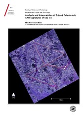
| dc.description.abstract | Operational sea ice charts are currently produced manually, an inefficient process resulting in subjective ice charts. Hence, there is a need for automating this procedure. This thesis investigates how polarimetric microwave radar signatures relate to the physical properties of sea ice, and how these signatures may contribute to the development of robust automatic algorithms. Our analyses are based on polarimetric space-borne synthetic aperture radar (SAR) scenes co- with in-situ data obtained north of Svalbard in April 2011.
The thesis consists of three papers.
The first paper investigated the performance of a feature based automatic segmentation algorithm and compared it to two manual drawn ice charts. The analysis revealed big discrepancies between the ice charts and demonstrated benefits of incorporating polarimetric information in sea ice charting.
The objective of the second paper was to explore the transferability of information from one scene to another. Three overlapping scenes from consecutive days were automatically segmented. Utilising one scene as reference, two strategies for labelling the other scenes were explored. The analysis showed that under stable environmental conditions and an incidence angle difference of ∼ 7◦ between the reference scene and the test scene, the results were reasonable.
In the third paper we investigated the classification potential of 44 polarimetric features. Ground-truth pixels were manually selected and input to an automatic feature selection process. The feature subsets were input to classifier and evaluated based on the number of correctly classified pixels. The best feature subset included six features. These achieved a classification accuracy of 70%, reflecting the complexity of the scene | en |
| dc.description.doctoraltype | ph.d. | en |
| dc.description.popularabstract | Operasjonelle iskart blir per dags dato utarbeidet manuelt og baserer seg hovedsakelig på satellittbilder fra syntetisk apertur-radar (SAR). Dette er tidkrevende og resulterer i subjektive iskart. I denne avhandlinga undersøker vi hvordan informasjonen i radarbilder av is kan tolkes i lys av isens egenskaper, og hvordan denne kan brukes i utviklingen av automatiske klassifiseringsalgoritmer. Vi studerer også hvilke kombinasjoner av parametere, beregnet fra SAR-bilder, som best kjennetegner ulike is-typer. Studien baserer seg på satellitt- og bakkedata samlet inn nord for Svalbard i april 2011.
Analysen gir økt kunnskap om sammenhengen mellom informasjonen i radarbildet og isens egenskaper. I tillegg demonstrerer vi at påliteligheten i et automatisk generert iskart avhenger av den benyttede parameterkombinasjonen. Vi foreslår en metode for utvelgelse av de beste parameterne for et gitt satellittbilde. Metoden er basert på enkle statistiske algoritmer. | en |
| dc.description.sponsorship | RDA Troms, gjennom DARESS prosjektet (Hovedfinansiering).
The project “Sea Ice in the Arctic Ocean, Technology and Systems of Agreements” (“Polhavet”, subproject “CASPER”) of the Fram Centre | en |
| dc.description | Paper 2 and 3 of this thesis are not available in Munin:<br> 2. M.-A. N. Moen, S. N. Anfinsen, A. P. Doulgeris, A. H. H. Renner, S. Gerland:’ An inter-comparison of techniques to classify polarimetric SAR images of sea ice’. Annals of Glaciology. (In Review)<br> 3. M.-A. Moen, A. P. Doulgeris, S. N. Anfinsen, Torbjørn Eltoft: ‘Feature selection for sea ice classification of polarimetric SAR scenes’. (Manuscript). | en |
| dc.identifier.uri | https://hdl.handle.net/10037/7049 | |
| dc.identifier.urn | URN:NBN:no-uit_munin_6636 | |
| dc.language.iso | eng | en |
| dc.publisher | UiT Norges arktiske universitet | en |
| dc.publisher | UiT The Arctic University of Norway | en |
| dc.rights.accessRights | openAccess | |
| dc.rights.holder | Copyright 2015 The Author(s) | |
| dc.rights.uri | https://creativecommons.org/licenses/by-nc-sa/3.0 | en_US |
| dc.rights | Attribution-NonCommercial-ShareAlike 3.0 Unported (CC BY-NC-SA 3.0) | en_US |
| dc.subject | Remote sensing | en |
| dc.subject | Synthetic Aperture Radar | en |
| dc.subject | Sea ice | en |
| dc.subject | Earth Observation | en |
| dc.subject | Ice charting | en |
| dc.subject | Polarimetry | en |
| dc.subject | Image segmentation/classification | en |
| dc.title | Analysis and Interpretation of C-band Polarimetric SAR signatures of Sea Ice | en |
| dc.type | Doctoral thesis | en |
| dc.type | Doktorgradsavhandling | en |


 English
 norsk
norsk

