

 English
 norsk
norskLate Weichselian ice-sheet dynamics and deglaciation history of the northern Svalbard margin
| dc.contributor.advisor | Noormets, Riko | |
| dc.contributor.author | Fransner, Oscar | |
| dc.date.accessioned | 2018-05-29T10:43:06Z | |
| dc.date.available | 2018-05-29T10:43:06Z | |
| dc.date.issued | 2018-05-04 | |
| dc.description.abstract | This thesis presents new results from marine geological and geophysical studies based on sediment gravity cores, airgun, subbottom acoustic and high-resolution swath bathymetric data from fjords, the continental shelf and slope north of Nordaustlandet, Svalbard. From these records, the glacial landform assemblages as well as the glacial and postglacial sedimentary environments were interpreted. Where possible, 14C dating was performed to reconstruct the timing of deglaciation. Research presented in this thesis contributes to a better understanding of the extent, timing and rates of decay of the Svalbard-Barents Sea Ice Sheet (SBIS) during the Late Weichselian, as well as to the understanding of the glacial and interglacial processes that have shaped the northern Svalbard margin. Kvitøya and Albertini Troughs hosted streaming ice during the Quaternary. While Kvitøya Trough has a well-developed Trough Mouth Fan (TMF) at its mouth, Albertini Trough mouth is withdrawn and lacks a TMF. The extra accommodation space for sediments created by downfaulted bedrock below Albertini Trough mouth is likely the main reason for the lack of a TMF off Albertini Trough, which shows the influence of local structural geology on TMF build-up. Depth contours of the International Bathymetric Chart of the Arctic Ocean (IBCAO) indicate the presence of cross-shelf troughs off Duvefjorden and Albertinibukta, suggesting the source areas for the repeated ice flows feeding Albertini Trough during the Quaternary. Subglacial landforms in Rijpfjorden and Duvefjorden suggest northerly flowing ice streams in both fjords during the Last Glacial Maximum (LGM). The higher elongation ratio of the subglacial landforms in Duvefjorden and the deeper fjord basin there, suggest a larger and/or more focused ice flow in Duvefjorden compared to in Rijpfjorden. Listric fault scarps in the Quaternary sediments of Albertini Trough mouth formed during early deglaciation due to a locally unstable sediment stratigraphy there. Overridden terminal moraines with De Geer and push moraines on top, as well as a grounding zone wedge superimposed by glacial lineations indicate multiple readvances of the grounded ice sheet during a generally slow deglaciation of the central Albertini Trough. The deglacial dynamics in Albertini Trough are partly attributed to the shallowing and narrowing of the trough itself, which facilitated ice sheet grounding there. A southwards orientation change from S-N to SSW-NNE of the glacial lineations in Albertini Trough indicates that the ice flow from Duvefjorden became increasingly dominant during deglaciation. Radiocarbon dates from the continental shelf west of Albertini Trough suggest that the retreat of the SBIS front significantly increased with time during deglaciation. The absence of retreat-related landforms in Rijpfjorden’s deeper areas (>-210 m) as well as in Duvefjorden, suggests the presence of floating glacier fronts influenced by calving during deglaciation. Radiocarbon dates from inner Rijpfjorden and central Duvefjorden indicate that these areas were deglaciated before c. 10.6 ka and 11.0 ka, respectively. The thickness of the deglacial-postglacial sediments in Rijpfjorden and Duvefjorden reaches up to 26 m, which gives linear accumulation rates of c. 66 cm/kyr. The high sedimentation rates and steep slopes in the fjords were important for triggering mass flows, common in both fjords during the Holocene. | en_US |
| dc.description.doctoraltype | ph.d. | en_US |
| dc.description.popularabstract | Marine terminating ice sheets are capable of rapidly transfer ice from their interiors to their margins. In turn, the climatic and oceanic conditions at the margins may enhance collapse of these margins which could have consequences for the global sea level. In order to increase our understanding of the interaction between climate, sea level change and the behavior and presence of glaciers, the study of marine-based ice sheets becomes important. This study focuses on the configuration, timing and deglaciation of the Svalbard-Barents Sea Ice Sheet (SBIS) on the continental shelf and slope north of Nordaustlandet during the late Weichselian. The study was performed using sediment cores and geophysical data from airgun, chirp and multibeam sonars. These data sets were used to study sediments of both glacial and post glacial origin and for mapping of glacial landforms on the sea bed. When possible, the carbon-14 method was used to date the sediments which gives a hint of the timing of deglaciation of the continental shelf. The main results show that significant amounts of Weichselian glacial sediments have accumulated off Kvitøya Trough while such sediments are absent off the neigbouring Albertini Trough. The glacial sediments in Albertini Trough are instead trapped at the continental shelf edge due to local differences in structural geology. Ice streams occupied Rijpfjorden and Duvefjorden at northern Nordaustlandet during Late Wecihselian. Although both ice streams drained the SBIS, it is likely that the ice stream in Duvefjorden had a larger volume compared to the one in Rijpfjorden. The Duvefjorden ice stream continued northwards over the continental shelf through Albertini Trough, and reached the continental edge during the Last Glacial Maximum (LGM). Deglaciation of Albertini Trough was relatively slow, and was interrupted by reactivations of the ice stream. Carbon-14 dates indicate that deglaciation rate of the continental shelf increased over time. The increasing sea level during deglaciation probably played an important role for the behaviour of deglaciation, since the ice front in deeper areas became floating and was affected by calving there. Deglaciation of Rijpfjorden was complete around 10.6 cal. Ka BP, which indicates that the complete deglaciation of the continental shelf north of Nordaustlandet took approximately 8000 years. | en_US |
| dc.description.sponsorship | This research has received funding from the People Programme (Marie Curie Actions) of the European Union’s Seventh Framework Programme FP7/2007-2013/ under REA grant agreement n° 317217. The research forms part of the GLANAM (GLAciated North Atlantic Margins) Initial Training Network. | en_US |
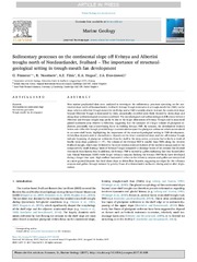
| dc.description | The paper III is not available in Munin.<br> Paper III: Fransner, O., Noormets, R., Chauhan, T., O’Regan, M. & Jakobsson, M. (2018). Late Weichselian ice stream configuration and dynamics in Albertini Trough, northern Svalbard margin. Available in <a href=https://doi.org/10.1007/s41063-017-0035-6> Arktos, 4(1).</a> | en_US |
| dc.identifier.isbn | 978-82-8236-296-2 (trykt) og 978-82-8236-297-9 (pdf) | |
| dc.identifier.uri | https://hdl.handle.net/10037/12797 | |
| dc.language.iso | eng | en_US |
| dc.publisher | UiT Norges arktiske universitet | en_US |
| dc.publisher | UiT The Arctic University of Norway | en_US |
| dc.rights.accessRights | openAccess | en_US |
| dc.rights.holder | Copyright 2018 The Author(s) | |
| dc.rights.uri | https://creativecommons.org/licenses/by-nc-sa/3.0 | en_US |
| dc.rights | Attribution-NonCommercial-ShareAlike 3.0 Unported (CC BY-NC-SA 3.0) | en_US |
| dc.subject | VDP::Matematikk og Naturvitenskap: 400::Geofag: 450 | en_US |
| dc.subject | VDP::Mathematics and natural science: 400::Geosciences: 450 | en_US |
| dc.title | Late Weichselian ice-sheet dynamics and deglaciation history of the northern Svalbard margin | en_US |
| dc.type | Doctoral thesis | en_US |
| dc.type | Doktorgradsavhandling | en_US |
File(s) in this item

This item appears in the following collection(s)

Except where otherwise noted, this item's license is described as Attribution-NonCommercial-ShareAlike 3.0 Unported (CC BY-NC-SA 3.0)