| dc.contributor.advisor | Juha, Vierinen | |
| dc.contributor.author | Stamm, Johann | |
| dc.date.accessioned | 2022-05-11T07:37:24Z | |
| dc.date.available | 2022-05-11T07:37:24Z | |
| dc.date.issued | 2022-05-24 | |
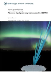
| dc.description.abstract | A new, modern ionospheric radar, called EISCAT3D, is under construction in northern Fennoscandia. In the first stage, the radar will have three sites, one combined transmit/receiver site shouth of Skibotn, and receiver sites in Kaaresuvanto and Kaiseniemi. The radar will consist of large groups of dipole antennas that are steered by shifting the phase of the transmitted or received signal. The beam steering is performed by a computer such that the radar can form several receive beams simultaneously. The antenna field of EISCAT3D can be divided into groups that can receive separately. This can be used to image how the received signal intensity varies in the area covered by the receiver beam. For EISCAT3D, it will be possible to image the electron density in the E region if the signal is strong enough. Then, imaging can be done with a resolution of around 100 m x 100 m per pixel at a distance of 100 km. Such measurements enable researching the spatial variation for instance in auroral arcs. EISCAT3D will be able to measure the ion velocity with greater presition in time and space than earlier radars. Together with fast antenna steering, this gives new possibilities to estimate electric field and neutral wind in the ionosphere. A newly developed technique shows that EISCAT3D measurements can be used to obtain spatially resolved estimates of electric field and neutral wind in three dimensions. The technique builds upon theory about inverse problems, Maxwell’s equations, and assumptions about continuity and small variations in the neutral wind. With this technique. It will become possible to study how the electric field varies in and around aurora. | en_US |
| dc.description.abstract | En toppmoderne ionosfæreradar, kalt EISCAT3D, er under bygging på Nordkalotten. I første omgang får radaren tre lokasjoner, en kombinert sender og mottaker sør for Skibotn og rene mottakere i Kaaresuvanto og Kaiseniemi. Radaren kommer til å bestå av store grupper av dipolantenner som styres ved å forskyve fasen i signalet hver antenne sender ut eller mottar. Stråleretninga styres av en datamaskin slik at radaren kan danne flere mottakerstråler samtidig. Antennefeltet til EISCAT3D kan deles opp i grupper som tar imot signal hver for seg. Dette gjør det mulig å avbilde hvordan den mottatte signalstyrken varierer i området som dekkes av mottakerstrålen. Det vil bli mulig for EISCAT3D å avbilde elektrontetthet i E-laget dersom signalet er sterkt nok. Da kan avbildninger gjøres med ei oppløsning på rundt 100 m x 100 m per piksel ved en avstand på 100 km. Slike målinger gjør det mulig å undersøke den romlige variasjonen i f.eks. nordlysbuer. EISCAT3D kommer til å måle ionevinden med større presisjon i tid og rom enn tidligere radarer. Sammen med rask antennestyring gir dette nye muligheter for å estimere elektrisk felt og nøytralvind i ionosfæren. En nyutvikla teknikk viser at EISCAT3D-målinger kan gi romlig oppløste estimat av elektrisk felt og nøytralvind i tre dimensjoner. Teknikken bygger på teori om inversjonsproblemer, Maxwells likninger og antakelser om kontinuitet og små variasjoner i nøytralvinden. Med denne teknikken vil det bli mulig å undersøke hvordan det elektriske feltet ender seg i og rundt nordlys. | en_US |
| dc.description.doctoraltype | ph.d. | en_US |
| dc.description.popularabstract | For å bli bedre kjent med den øvre atmosfæren og nordlyset, har forskningssamarbeidet EISCAT satt i gang bygging av radaren EISCAT3D på Nordkalotten. Radaren består av et stort antall antenner som styres ved å legge til små forsinkelser i signalet til eller fra hver antenne.
Antennefeltet kan deles opp i mindre grupper, som gjør det mulig å finne ut hvordan elektriske ladninger fordeler seg på tvers av retninga radaren ser. Dette krever at signalet er sterkt nok, som med EISCAT3D vil være mulig i høydeområdet mellom 90 og 120 km. Oppløsninga er god nok til å undersøke variasjoner på størrelser ned mot 100 meter. En annen ny måleteknikk er å styre radaren i mange ulike retninger for å få målinger over et stort område. Gjennom avansert matematikk kan vi legge fysiske føringer på resultatene for å få et tredimensjonalt bilde av elektriske felt den øvre atmosfæren.
To become more familiar with the upper atmosphere and the northern lights, the research cooperation EISCAT has begun building the radar EISCAT3D in northern Fennoscandia. The radar consists of a large group of antennas that are steered by adding small delays into the signal to or from every antenna. The antenna field can be divided into minor groups. This makes it possible to study how electrical charges distribute across the direction the radar is looking at. This requires that a strong signal, which for EISCAT3D will come from altitudes between 90 and 120 km. The resolution is good enough for studying variations with size down to 100 meters. Another new measurement technique is to steer the radar in many different directions to obtain measurements over a large volume. Through advanced math, we can constrain the results with physics and obtain a three-dimensional image of the electric field in the upper atmosphere. | en_US |
| dc.description.sponsorship | Tromsø forskningsstiftelse, prosjekt "Radar science with EICAT3D" | en_US |
| dc.identifier.isbn | 978-82-8236-476-8 | |
| dc.identifier.uri | https://hdl.handle.net/10037/25066 | |
| dc.language.iso | eng | en_US |
| dc.publisher | UiT Norges arktiske universitet | en_US |
| dc.publisher | UiT The Arctic University of Norway | en_US |
| dc.relation.haspart | <p>Paper I: Stamm, J., Vierinen, J., Urco, J.M., Gustavsson, B. & Chau, J.L. (2021). Radar Imaging with EISCAT 3D. <i>Annales Geophysicae, 39</i>(1), 119–134. Also available in Munin at <a href=https://hdl.handle.net/10037/21830>https://hdl.handle.net/10037/21830</a>.
<p>Paper II: Stamm, J., Vierinen, J. & Gustavsson, B. (2021). Observing electrical field and neutral wind with EISCAT 3D. <i>Annales Geophysicae, 39</i>(6), 961–974. Also available in Munin at <a href=https://hdl.handle.net/10037/23189>https://hdl.handle.net/10037/23189</a>.
<p>Paper III: Stamm, J., Vierinen, J., Gustavsson, B. & Spicher, A. (2022). A technique for volumetric incoherent scatter radar analysis. <i>Annales Geophysicae Discussions</i>, preprint. Also available at <a href=https://doi.org/10.5194/angeo-2022-11>https://doi.org/10.5194/angeo-2022-11</a>. | en_US |
| dc.rights.accessRights | openAccess | en_US |
| dc.rights.holder | Copyright 2022 The Author(s) | |
| dc.rights.uri | https://creativecommons.org/licenses/by-nc-sa/4.0 | en_US |
| dc.rights | Attribution-NonCommercial-ShareAlike 4.0 International (CC BY-NC-SA 4.0) | en_US |
| dc.subject | VDP::Matematikk og Naturvitenskap: 400::Fysikk: 430::Rom- og plasmafysikk: 437 | en_US |
| dc.subject | VDP::Mathematics and natural science: 400::Physics: 430::Space and plasma physics: 437 | en_US |
| dc.subject | VDP::Matematikk og Naturvitenskap: 400::Informasjons- og kommunikasjonsvitenskap: 420::Simulering, visualisering, signalbehandling, bildeanalyse: 429 | en_US |
| dc.subject | VDP::Mathematics and natural science: 400::Information and communication science: 420::Simulation, visualization, signal processing, image processing: 429 | en_US |
| dc.subject | VDP::Matematikk og Naturvitenskap: 400::Informasjons- og kommunikasjonsvitenskap: 420::Matematisk modellering og numeriske metoder: 427 | en_US |
| dc.subject | VDP::Mathematics and natural science: 400::Information and communication science: 420::Mathematical modeling and numerical methods: 427 | en_US |
| dc.title | Advanced signal processing techniques with EISCAT3D | en_US |
| dc.type | Doctoral thesis | en_US |
| dc.type | Doktorgradsavhandling | en_US |


 English
 norsk
norsk


