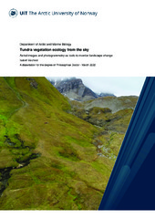
Tundra vegetation ecology from the sky - Aerial images and photogrammetry as tools to monitor landscape change
Permanent link
https://hdl.handle.net/10037/25016Date
2022-05-24Type
Doctoral thesisDoktorgradsavhandling
Author
Eischeid, IsabellAbstract
Has part(s)
Paper I: Ravolainen, V., Soininen, E.M., Jónsdóttir, I.S., Eischeid, I., Forchhammer, M., van der Wal, R. & Pedersen, Å.Ø. (2020). High Arctic ecosystem states: Conceptual models of vegetation change to guide long-term monitoring and research. Ambio, 49, 666-677. Also available in Munin at https://hdl.handle.net/10037/19080.
Paper II: Eischeid I., Soininen, E.M., Assmann, J.J., Ims, R.A., Madsen, J., Pedersen, Å.Ø., Pirotti, F., Yoccoz, N.G. & Ravolainen, V.T. (2021). Disturbance Mapping in Arctic Tundra Improved by a Planning Workflow for Drone Studies: Advancing Tools for Future Ecosystem Monitoring. Remote Sensing, 13(21), 4466. Also available in Munin at https://hdl.handle.net/10037/23541.
Paper III: Eischeid I., Soininen, E.M., Keeves, K., Madsen, J., Nolet, B., Pedersen, Å.Ø., Yoccoz, N.G. & Ravolainen, V.T. Snowmelt progression drives spring habitat selection and vegetation disturbance by an Arctic avian herbivore at multiple scales. (Manuscript).
Paper IV: Bernsteiner, H., Brožová, N., Eischeid, I., Hamer, A., Haselberger, S., Huber, M., Kollert, A., Vandyk, T.M. & Pirotti, F. (2020). Machine learning for classification of an eroding scarp surface using terrestrial photogrammetry with NIR and RGB imagery. ISPRS Annals of the Photogrammetry, Remote Sensing and Spatial Information Sciences, V-3-2020, 431-437. Also available in Munin at https://hdl.handle.net/10037/24970.
Publisher
UiT The Arctic University of NorwayUiT Norges arktiske universitet
Metadata
Show full item recordCollections
The following license file are associated with this item:


 English
 norsk
norsk
