| dc.contributor.advisor | Anfinsen, Stian Normann | |
| dc.contributor.author | Luppino, Luigi Tommaso | |
| dc.date.accessioned | 2020-05-29T07:39:32Z | |
| dc.date.available | 2020-05-29T07:39:32Z | |
| dc.date.issued | 2020-06-16 | |
| dc.description.abstract | <p><i>Change detection</i> is a thriving and challenging topic in remote sensing for Earth observation. The goal is to identify changes that happen on the Earth by comparing two or more satellite or aerial images acquired at different times. Traditional methods rely on homogeneous data, that is, images acquired by the same sensor, under the same geometry, seasonal conditions,and recording configurations.
<p>However, the assumption of homogeneity does not hold true for many practical examples and applications, and in particular when different sensors are involved. This represents a significant limitation, both in terms of response time to sudden events and in terms of temporal resolution when monitoring long-term trends.
<p>The alternative is to combine heterogeneous data, which on one hand allows to fully exploit the capabilities of all the available sensors, but on the other hand raises additional technical challenges. Indeed, heterogeneous sources imply different data domains, diverse statistical distributions and inconsistent surface signatures across the various image acquisitions.
<p>This thesis tries to explore the kinds of techniques meant to cope with these issues, which are referred to as heterogeneous change detection methods. Specifically, the effort is dedicated to unsupervised learning, the branch of machine learning which does not rely on any prior knowledge about the data. This problem setting is as challenging as important, in order to tackle the task in the most automatic way without relying on any user interaction.
<p>The main novelty driving this study is that the comparison of affinity matrices can be used to define crossdomain similarities based on pixel relations rather than the direct comparison of radiometry values. Starting from this fundamental idea, the research endeavours presented in this thesis result in the formulation of three methodologies that prove themselves reliable and perform favourably when compared to the state-of-the-art. These methods leverage this affinity matrix comparison and incorporate both conventional machine learning techniques and more contemporary deep learning architectures to tackle the problem of unsupervised heterogeneous change detection. | en_US |
| dc.description.doctoraltype | ph.d. | en_US |
| dc.description.popularabstract | Comparing apples and oranges - and making sense of it
Change detection is an important application in earth observation with satellite images. Change detection can for instance be used to detect deforestation or flooded areas. It is traditionally done by comparing images recorded under conditions that should be as similar as possible. The normal approach is to compare images from the same instrument and sensor mode, such that the measurements at two separate times can be directly compared and where a difference close to zero represents «no change». This requires, however, exact corrections and co-calibration of the images, which is difficult due to common variation of sensor geometry and environmental parameters that change with weather and season.
The quest posed here is less obvious: How to compare different images from different sensors in order to find changes between them? - It is a bit like comparing apples and oranges - in a sensible fashion. The motivation is both to perform faster and more extensive analyses. With heterogeneous change detection there is no need to wait for an image taken by the same sensor after an event of interest. Since the method uses all kinds of images, changes can be detected as soon as any given image is available. The ability to compare different sensors also provides longer and denser time series of data, that can be used to extend the analysis in time span and temporal resolution.
This makes for better exploitation of the vast amounts of satellite images that are captured.
The concept of heterogeneous or multimodal change detection is very new, and the challenge is hereby addressed with advanced methods from statistics and machine learning. The developed methods use the last innovations within artificial intelligence and deep learning, demonstrating their great usefulness for the detection of e.g. forest fires and floodings on time series of heterogeneous images. | en_US |
| dc.description.sponsorship | The project was funded by the Research Council of Norway under research grant number 251327. | en_US |
| dc.identifier.isbn | 978-82-8236-399-0 (pdf) | |
| dc.identifier.uri | https://hdl.handle.net/10037/18399 | |
| dc.language.iso | eng | en_US |
| dc.publisher | UiT Norges arktiske universitet | en_US |
| dc.publisher | UiT The Arctic University of Norway | en_US |
| dc.relation.haspart | <p>Paper I: Luppino, L.T., Bianchi, F.M., Moser, G. & Anfinsen, S.N. (2019). Unsupervised image regression for heterogeneous change detection. <i>IEEE Transactions on Geoscience and Remote Sensing, 57</i>(12), 9960-9975. Not available in Munin due to publisher’s restrictions. Available at <a href=https://doi.org/10.1109/TGRS.2019.2930348>https://doi.org/10.1109/TGRS.2019.2930348</a>. Accepted manuscript version available in Munin at <a href=https://hdl.handle.net/10037/17764>https://hdl.handle.net/10037/17764</a>.
<p>Paper II: Luppino, L.T., Kampffmeyer, M., Bianchi, F.M., Moser, G., Serpico, S.B., Jenssen, R. & Anfinsen, S.N. Deep image translation with an affinity-based change prior for unsupervised multimodal change detection. (Submitted manuscript).
<p>Paper III: Luppino, L.T., Hansen, M.A., Kampffmeyer, M., Bianchi, F.M., Moser, G., Jenssen, R. & Anfinsen, S.N. Code-aligned autoencoders for unsupervised change detection in multimodal satellite images. (Submitted manuscript). | en_US |
| dc.relation.projectID | info:eu-repo/grantAgreement/RCN/ROMFORSK/251327/Norway/Change detection in heterogeneous remote sensing images// | en_US |
| dc.rights.accessRights | openAccess | en_US |
| dc.rights.holder | Copyright 2020 The Author(s) | |
| dc.rights.uri | https://creativecommons.org/licenses/by-nc-sa/4.0 | en_US |
| dc.rights | Attribution-NonCommercial-ShareAlike 4.0 International (CC BY-NC-SA 4.0) | en_US |
| dc.subject | VDP::Mathematics and natural science: 400::Information and communication science: 420::Simulation, visualization, signal processing, image processing: 429 | en_US |
| dc.subject | VDP::Matematikk og Naturvitenskap: 400::Informasjons- og kommunikasjonsvitenskap: 420::Simulering, visualisering, signalbehandling, bildeanalyse: 429 | en_US |
| dc.subject | VDP::Mathematics and natural science: 400::Mathematics: 410::Applied mathematics: 413 | en_US |
| dc.subject | VDP::Matematikk og Naturvitenskap: 400::Matematikk: 410::Anvendt matematikk: 413 | en_US |
| dc.subject | VDP::Mathematics and natural science: 400::Mathematics: 410::Statistics: 412 | en_US |
| dc.subject | VDP::Matematikk og Naturvitenskap: 400::Matematikk: 410::Statistikk: 412 | en_US |
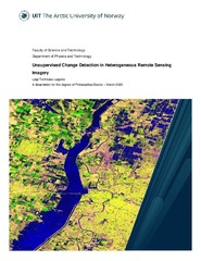
| dc.title | Unsupervised Change Detection in Heterogeneous Remote Sensing Imagery | en_US |
| dc.type | Doctoral thesis | en_US |
| dc.type | Doktorgradsavhandling | en_US |


 English
 norsk
norsk


