Mastergradsoppgaver i geologi: Recent submissions
Now showing items 121-140 of 296
-
A combined 3D seismic and sedimentological study of the Lower Cretaceous succession in the northeastern part of the Nordkapp Basin
(Master thesis; Mastergradsoppgave, 2018-05-15)In this master’s thesis in geology, 3D seismic data and shallow stratigraphic cores were used to investigate the Lower Cretaceous succession in the central sub-basin of the Nordkapp Basin, Barents Shelf. The Lower Cretaceous is listed as a potential petroleum play model on the Barents Shelf, which makes the succession of interest for petroleum exploration. Recent studies of the have divided the ... -
The role of diapiric mound structures in the overburden fluid plumbing systems of the Vøring Basin
(Master thesis; Mastergradsoppgave, 2018-05-15)The overall aim of this thesis is to better understand the development and emplacement of diapiric mound features in the Vema Dome area, located in the Vøring basin on the mid-Norwegian continental margin. Two 3D seismic surveys, ST9603R99 and BPN9601, were interpreted in this study, in order to investigate the diapiric mounds and their relationship with an underlying fluid plumbing system including ... -
Interaction of submarine tailings with natural sediments in three northern Norwegian coastal areas. Sedimentological, mineralogical and geochemical constraints
(Master thesis; Mastergradsoppgave, 2018-05-15)Submarine tailings placements (STPs) is an alternative practice of handling mine waste, which involves deposition of tailings into submarine environments. However, the environmental impacts of STPs remain poorly understood. This thesis is a contribution to improve the understanding of how submarine tailings placements interact with natural sediments. It is based on multi-proxy analyses of 10 sediment ... -
Controls on fluid-flow systems in the Loppa High, SW Barents Sea
(Master thesis; Mastergradsoppgave, 2018-05-14)The SW Barents Sea is a large hydrocarbon-prone epicontinental Sea comprised of a complex mosaic of deep sedimentary basins and structural highs. Uplift and erosion have been affecting the area on a large scale since the Cenozoic and have had a major impact on the petroleum systems in the area, resulting in spillage of hydrocarbons. The origin of the hydrocarbons are from deep source rocks, which ... -
Sedimentary processes and paleoenvironment reconstructions in fjords comprising the Bergsfjord peninsula, Northern Norway
(Master thesis; Mastergradsoppgave, 2018-05-16)Low-resolution bathymetry, high-resolution seismic data (chirp) and multi-proxy analyses of three sediment gravity cores were integrated to study sedimentary processes with the purpose of reconstructing paleoenvironments in the three north Norwegian fjords Øksfjorden, Bergsfjorden and Jøkelfjorden since the last glacial. These three fjords are located on the Bergsfjorden peninsula and surround the ... -
A sedimentological study of the Lower Cretaceous Glitrefjellet Member, Svalbard
(Master thesis; Mastergradsoppgave, 2018-05-15)Detailed facies analysis of the Early Cretaceous Helvetiafjellet Formation (Barremian-Aptian) indicates deposition during a long-term transgression. The formation has received a lot of attention in previous published papers, particularly the lowermost Festningen Member has been detailed in numerous papers. However, the uppermost Glitrefjellet Member is typically poorly exposed in outcrops, and ... -
Characterisation of palaeosols in the Lower Cretaceous Helvetiafjellet Formation, Svalbard. Palaeo-climatic implications
(Master thesis; Mastergradsoppgave, 2018-05-15)Although the Cretaceous period is known to have been dominated by greenhouse conditions, the Early Cretaceous climatic conditions in Svalbard have been under some debate. Both indicators of warm climate such as coal seams, Ornithopod tracks and warm-water dinoflagellates, and indicators of cold climate such as arctic belemnites, glendonites and ice rafted debris have been reported. This study ... -
Natural and anthropogenic deposition in Bøkfjorden
(Master thesis; Mastergradsoppgave, 2018-05-15)The aim for this study is to characterise and distinguish natural and anthropogenic deposition in Bøkfjorden, and to identify the spreading and the impact of submarine tailings placements on the seafloor. The analyses are based on the integration of swath bathymetry, high-resolution seismics and multi-proxy analyses of four sediment cores The physical properties, including magnetic susceptibility ... -
Integrated characterization of the Upper Permian Kapp Starostin Formation in central Spitsbergen, Svalbard. From outcrop to geomodel.
(Master thesis; Mastergradsoppgave, 2018-05-14)Natural fractures significantly contribute to improved reservoir quality and recovery factor, especially in carbonate reservoirs. It is important to characterize the matrix and fracture properties, as well as their interaction, in order to describe the natural fracture system and improve the understanding of its effects on a reservoir. This study integrates multi-scale outcrop data from central ... -
U-Pb zircon provenance of metamorphosed clastic sediments in the Brusque Metamorphic Complex, Dom Feliciano Belt, southeastern Brazil
(Master thesis; Mastergradsoppgave, 2018-05-15)The Brusque Metamorphic Complex is situated in the northern part of the Dom Feliciano Belt in the state of Santa Catarina, southeastern Brazil. The complex is composed of Neoproterozoic sequences of volcanic and sedimentary rocks, which were folded and metamorphosed at greenschist to low-amphibolite facies conditions. U-Pb dating of detrital zircon grains in five samples of clastic metasedimentary ... -
Metamorphic evolution in external zones of the Dom Feliciano-Kaoko orogenic system. Examples from the Brusque Metamorphic Complex, Dom Feliciano Belt (Brazil) and the Central Kaoko Zone, Kaoko Belt (Namibia)
(Master thesis; Mastergradsoppgave, 2018-05-15)The Brusque Metamorphic Complex in the Dom Feliciano Belt (Brazil) and the Central Kaoko Zone in the Kaoko Belt (Namibia) represent foreland fold- and thrust belts in external parts of the northern Dom Feliciano-Kaoko orogenic system. Petrographic and field observations of metapelitic samples from the Brusque Metamorphic Complex suggests that the western part of the complex can be subdivided into ... -
Combining geophysical data with a mathematical model to describe vertical two-phase flow
(Master thesis; Mastergradsoppgave, 2018-05-15)This thesis combines a geological model with a mathematical model to describe the vertical propagation of a gas plume through layers with different physical properties. The geological model is based on geophysical data from the Sørvestsnaget Basin and the mathematical model is derived based on the classical Buckley-Leverett theory for two-phase flow. The model estimates the velocity of a vertical ... -
Use of 2D-seismic data and available wells to investigate the source potential of the Palaeozoic interval in the Loppa High area, SW Barents Sea
(Master thesis; Mastergradsoppgave, 2018-05-15)While most established plays in the Barents Sea have occurred in the Mesozoic, the Alta and Gohta discoveries prove a new carbonate play concept, with a source rock that does not stem from the Jurassic. Based on depositional environment and TOC values from the Palaeozoic interval a source rock with Top Ørn as its bottom and Top Røye as its top was interpreted. Basin modelling carried out on this ... -
Holocene Glacial Dynamics of the Barentsøya ice cap, Svalbard
(Master thesis; Mastergradsoppgave, 2018-05-13)This study investigates the glacial dynamics of Barentsjøkulen, a small ice cap located on Barentsøya, Svalbard. In order to reconstruct Barentsjøkulen’s glacial history, three geomorphological maps of the glacier forefields of its main outlet glaciers, Besselsbreen, Duckwitzbreen and Freemanbreen, were created. The maps cover a total area of ca. 117 km2 and were generated based on swath bathymetric ... -
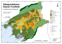
Glacial history and forefield development of Aldegondabreen since the Little Ice Age maximum extent
(Master thesis; Mastergradsoppgave, 2018-05-15)A geomorphological map has been produced to investigate the glacial history of Aldegondabreen, a small land terminating valley glacier located on the western coast of Spitsbergen. The glacier has changed its dynamic from a tidewater glacier into a land-terminating glacier during the last advance/retreat cycle, and the focus is therefore to reconstruct the glacial history of this cycle. The map ... -
Geological controlling parameters on seismic imaging of igneous intrusions on Svalbard
(Master thesis; Mastergradsoppgave, 2017-05-15)Imaging and mapping igneous intrusions such a sills and dykes has been one of the challenges in recent years. However, igneous intrusions in seismic data have properties that make them good targets for visualization, such as high amplitude and sophisticated shapes. 3D visualization methods are especially well suited for sill reflections. One of the main limitations of tying offshore seismic data to ... -
Evaluering av automatiske snøskredvarslingsanlegg
(Master thesis; Mastergradsoppgave, 2017-12-01)Noen veger blir stengt på ubestemt tid på grunn av snøskredfare. Dette er frustrerende for trafikanter og det skaper økonomiske konsekvenser for næringslivet. Statens vegvesen (SVV) har testet ut to teknologier for å detektere og varsle snøskred i sanntid; doppler radar og geofoner. Radaren bruker radiobølger for å måle retning og avstand til et objekt og kan dermed benyttes til å bestemme om skredet ... -
Comparison and classification of an Arctic Transitional snow climate in Tromsø, Norway
(Master thesis; Mastergradsoppgave, 2017-10-11)Winter tourism in Tromsø has increased significantly over the last years, consequently also the skiing tourism. It is advertised that Tromsø has a mild coastal climate compared to other destinations at similar latitudes. Existing snow climate classes separate covers into a maritime, continental and a transitional class where persistent weak layers are rare in the maritime class. Rain and average air ... -
Volume measurements and change of Longyearbreen and Tellbreen, Svalbard
(Master thesis; Mastergradsoppgave, 2017-08-12)Climate change is a comprehensive field of research. The cryosphere is only a small portion of the entire spectrum but is still a very important constituent to try and understand. Thermal expansion of the oceans is the second largest cause for sea level rise around the world after the global melting of glaciers and ice sheets combined. Even the smallest valley glaciers, with small individual volumes, ... -
Strukturgeologisk og geomorfologisk studium av fjellskred ved Skredan, Tromsø kommune
(Master thesis; Mastergradsoppgave, 2017-09-06)Hovedfokuset med denne oppgaven har vært å få en forståelse for betydningen av sprø og duktile strukturer i berggrunnen i forbindelse med skredet ved Skredan. Studiet innebærer kartlegging av strukturer i berggrunnen, innsamling av strukturdata og kartlegging av morfologiske elementer og relatere de ulike morfologiske elementene til strukturer i berggrunnen. Berggrunnen ved Skredan består av godt ...


 English
 norsk
norsk


