English
 norsk
norskMastergradsoppgaver i geologi: Recent submissions
Now showing items 221-240 of 296
-
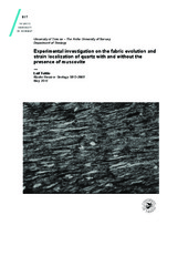
Experimental investigation on the fabric evolution and strain localization of quartz with and without the presence of muscovite
(Master thesis; Mastergradsoppgave, 2014-05-16)Deformation experiments of synthetic quartz–muscovite aggregates were performed to high shear strains at dislocation creep conditions in quartz. In previous studies, axial compression experiments were conducted on quartz aggregates to develop a better understanding of the relationship between flow strength and lattice preferred orientation with varying percentages of muscovite. Other analyses have ... -
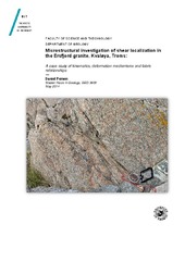
Microstructural investigation of shear localization in the Ersfjord granite, Kvaløya, Troms: A case study of kinematics, deformation mechanisms and fabric relationships
(Master thesis; Mastergradsoppgave, 2014-05-15)The present “case study” deals with Paleozoic-Mesozoic oblique-dextral strike-slip shear zones situated within the Ersfjord granite (1,79 Ga), that are believed to give valuable insight into fault- and fluid flow mechanics from the brittle-ductile transition zone. Mesoscopic observations combined with microstructural evidence and geochronology suggests that Late Carbonifereous-Early Triassic fault ... -
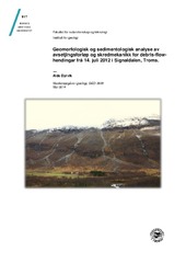
Geomorfologisk og sedimentologisk analyse av avsetjingsforløp og skredmekanikk for debris-flow-hendingar frå 14. juli 2012 i Signaldalen, Troms.
(Master thesis; Mastergradsoppgave, 2014-05-13)Debris-flow er ein type lausmasseskred som opptrer i alpine og arktiske landskap. I Noreg representerer dei ein naturfare både på Vestlandet, i Norland og i Troms. Prosessen har lenge vore studert utafor Noreg, men lite arbeid er gjort her i landet; denne oppgåva er meint å auka kunnskapen om debris-flows i Noreg, samt å vinkla den eksisterande kunnskapen mot eit typisk norsk risikoområde. Ein serie ... -
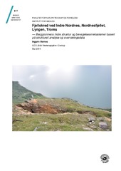
Fjellskred ved Indre Nordnes, Nordnesfjellet, Lyngen, Troms - Berggrunnens indre struktur og bevegelsesmekanismer basert på strukturell analyse og overvakingsdata
(Master thesis; Mastergradsoppgave, 2014-05-16)Gravitasjonell reaktivering av pre-eksisterande kaledonske duktile svakheitsoner i tillegg til post-kaledonske sprø strukturar som truleg har vorte utløyst ved glasial avlasting like etter nedsmeltinga av isen under siste istid har truleg gitt opphav til skråningsdeformasjonen og utviklinga av det ustabile fjellpartiet Indre Nordnes. Skredområde Indre Nordnes er initierande tektonisk styrt der ... -
Relationship between fluid leakage and faulting along the western and northern margin of the Hammerfest Basin
(Master thesis; Mastergradsoppgave, 2014-05-15)Abstract This thesis focuses on establishing a causal relationship between potential fluid sources, fluid migration pathways, shallow gas accumulations and potential gas hydrates in the western part of the Hammerfest Basin, SW Barents Sea. Two 3D seismic surveys (LN0901 and ST8320R00) were used to map fluid flow, stratigraphy, structure, fluid flow and other fluid-related features along the western ... -
POST-PRECAMBRIAN MAGMATISM IN EASTERN FINNMARK, NORWAY: MANTLE SOURCES, POSSIBLE ORIGINS AND DIAMOND POTENTIAL
(Master thesis; Mastergradsoppgave, 2013-12-15)Mantle sources under the Eastern Finnmark Region (EFR) appears to have inherited small scale heterogeneity from Precambrian geodynamics. Compositions varying from depleted and slightly enriched (similar to N-MORB and E-MORB), to enriched (similar to OIB type), are present in the EFR. Geochemical trends also indicates that some mantle sources has been to some extent influenced by subducting sediments, ... -
Mineralogy,geochemistry and ore potential of an ultramafic rock from the Kvaløya Island.
(Master thesis; Mastergradsoppgave, 2013-12-29)A low-grade metamorphic ultramafic rock at the Kvaløya Island, North Norway, shows Ni content up to 2 500 ppm. Olivine is absent from the rock, and Ni is principally bonded in pentlandite, violarite and millerite. Among other sulphide minerals found in the rock are pyrite, pyrrhotite, chalcopyrite, sphalerite, galena and heazlewoodite (?). Two generations of pyrite are observed in the rock. Second ... -
Paleo-klimatisk og oseanografisk utvikling i Ingøydjupet, gjennom deglasiasjon og Holosen, basert på undersøkelser av kornfordeling og bentiske foraminiferer
(Master thesis; Mastergradsoppgave, 2013-11-21)To kjerner fra Ingøydjupet i sørvest Barentshavet, 11HH-152MC og JM06-012GC, er blitt undersøkt for å undersøke den paleo-klimatiske og paleo oseanografiske utviklingen i Barentshavet. Dette er rekonstruert basert på undersøkelser av bentiske foraminiferer og kornfordeling. Kjernenes lengde er på henholdsvis ca 50 cm og 200 cm og 3 radiokarbon dateringer ligger til grunn for alderskronologien. ... -
Tectonic environment, geochemistry and petrology of the Tromsøysound iron ore
(Master thesis; Mastergradsoppgave, 2013-11-15)The geochemistry, mineralogy and associated basic rocks of the Tromsøysound iron ore field was studied for this thesis. The iron ore field is located in the Tromsø Nappe an ultra-high-pressure terrain in Troms, Northern-Norway, and has undergone some partial melting and metasomatism. The ore mineral is magnetite. The tectonic environment is investigated but inconclusive. -
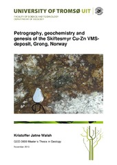
Petrography, geochemistry and genesis of the Skiftesmyr Cu-Zn VMS deposit, Grong, Norway
(Master thesis; Mastergradsoppgave, 2013-11-15)The Skiftesmyr Cu-Zn VMS-deposit is located in the Grong municipality of Northern Trøndelag, Norway. The mineralization has been known since at least 1903, when mention of small workings in the area were first published, and has later been the subject of several exploration projects by different companies, of which MetPro AS is the latest. The Skiftesmyr deposit is a part of the Gjersvik Nappe, ... -
Jettan, Nordnesfjellet, Kåfjord, Troms – indre geometri og struktur, kinematikk og styrande faktorar av eit ustabilt fjellparti, basert på strukturellanalyse, geomorfologi og overvakingsdata
(Master thesis; Mastergradsoppgave, 2013-11-21)Det ustabile fjellpartiet, Jettan, har blitt studert med ei multidisiplinær tilnærming. Dette inkluderer strukturelle og geomorfologiske analyser i felt, studiar av sann-tid og periodisk overvaking og bruk av kart og digitale elevasjonsmodellar. Formålet har vore å avdekke indre struktur og geometri, kinematikken og kontrollerande faktorar for dei ustabile massane. Det ustabile fjellpartiet er ... -
Deglasiasjon og postglasial dalinnfyllingshistorie i Målselvdalen : en syntese basert på egne undersøkelser i øvre Målselvdalen og tidligere arbeid i midtre og nedre Målselvdalen
(Master thesis; Mastergradsoppgave, 2013-08-14)Dalinnfylling i Målselvdalen Øst er kartlagt og beskrevet på bakgrunn av feltarbeid, kvartærgeologisk kartlegging og littaraturstudier. Det er også basert på tidligere (av andre) undersøkelser i Målselvdalen. Målet har vært å beskrive deglasial og postglasial innfylling av Målselvdalen Øst. -
Isstrømdynamikk og havbunnsgeomorfologi fra deglasiasjonen av det sørvestlige Barentshav, basert på 3D-, 2D-seismisk og batymetrisk data
(Master thesis; Mastergradsoppgave, 2013-08-15)Batymetridata og 2D og 3D seismisk data og er brukt for å kartlegge formelementer i det sørvestlige Barentshavet. Megaskala glasiale lineasjoner (MSGL) kartlagt i de glasiale trauene indikerer tidligere isstrømaktivitet i Bjørnøyrenna og Djuprenna. Dynamiske endringer i strømningsretning er påvist fra MSGL med ulike orienteringer som kutter hverandre. Ut fra kartlagte MSGL er 10 strømningssett laget. ... -
The Nussir copper deposit: petrology, mineralogy, geochemistry and distribution of ore mineralization
(Master thesis; Mastergradsoppgave, 2013-06-28)The geology, petrography, mineralogy and geochemistry of the Nussir copper deposit in Finnmark, Northern Norway were studied during writing this thesis. The Nussir deposit of copper is a sedimentary-hosted hydrothermal deposit affected by low grade methamorphism and ductile deformation. The copper mineralization includes chalcopyrite, chalcocite, bornite, covellite, and digenite. The deposit contains ... -
Slope displacement patterns observed using satellite InSAR data in the Storfjord-Kåfjord-Lyngen region, Troms
(Master thesis; Mastergradsoppgave, 2013-05-15)Norway is particularly susceptible to large rockslides due to its many fjords and steep mountains. One of the most dangerous hazards related to rock slope failures are tsunamis that can lead to large loss of life. Many rockslides are clustered east of the Storfjord and Lyngen fjord in Troms county, northern Norway, where several mapped unstable rock slopes occur within the zone of sporadic permafrost. ... -
Late Paleozoic-Cenozoic fault correlation and characterization of fault rocks in western Troms, North Norway
(Master thesis; Mastergradsoppgave, 2013-05-29)The present work focuses on the mapping and description of onshore brittle fault zones on the SW Barents Sea Margin, within gneisses and granitic intrusions belonging to the West Troms Basement Complex. The description of the brittle structures includes the geometry, kinematics and fault rock characteristics, using DEM satellite imaging, structural field work and a microstructural analysis of the ... -
Landform assemblages in inner Kongsfjorden, Svalbard: evidence of recent glacial (surge) activity
(Master thesis; Mastergradsoppgave, 2013-05-15)Swath bathymetry and chirp data have been used to investigate the submarine landform assemblages in inner Kongsfjorden, Svalbard, to reconstruct glacial dynamics during the Late Holocene. Multiple sets of landforms include two types of glacial lineations (groove-ridge features and small, drumlinoid ridges), terminal moraines and associated debris lobes, as well as small push moraines, and indicate ... -
Geomorfologi av glasiale sedimenter basert på 3D seismikk fra Nordkappbanken, SV Barentshav
(Master thesis; Mastergradsoppgave, 2013-05-15)Den kvartære lagpakken er analysert med fokus på glasial geomorfologi. Dette er gjort ved bruk av tre-dimensjonale (3D) seismiske data fra Nordkappbanken, sørvestlige Barentshav. I tillegg til havbunnen er det identifisert 2 begravde flater som begge er påvirket av glasiale prosesser. Geomorfologien til den stratigrafisk grunneste av de begravde flatene viser flere store depresjoner som er opp til ... -
Geological setting and origin of a gold-mineralized zone at Myrefjellet, Mauken, Troms
(Master thesis; Mastergradsoppgave, 2013-05-07)In 2008 Scandinavian Highlands discovered a gold mineralization within the Mauken basement window. The Mauken basement window is a thought to be an eastward continuation of the West Troms Basement Complex which is a series of rocks with an age span from Neoarchaean to Paleoproterozic. The mineralization found in a steeply dipping NW-SE striking shear zone and is hosted in a meta-sedimentary unit. ... -
Ice stream dynamics inferred from seismic geomorphology from the Bjørnøyrenna and Nordkappbanken area, SW Barents Sea
(Master thesis; Mastergradsoppgave, 2013-05-15)The aim of this master thesis is to investigate ice streams dynamics in Bjørnøyrenna and Nordkappbanken areas in south-west Barents Sea shelf Ice streams are responsible for the drainage of majority of ice from ice sheet and play a key role in the dynamic nature and stability of ice sheets, based mainly on six 3D seismic data sets,. Regional 2D lines are also used to establish the regional stratigraphy ...