English
 norsk
norskBlar i tittel Mastergradsoppgaver i geologi
Viser treff 95-114 av 271
-
Heinrich events of the late Pleistocene; evidence from a sediment core west of Jan Mayen. An analogue to present day ice sheet collapse?
(Master thesis; Mastergradsoppgave, 2017-05-15)A thorough lithological investigation of deep sea sediment core HH13-100GC has been undertaken, in order to investigate the climate and oceanographic fluctuations of the last glacial epoch. The cause of Heinrich events has remained an enigma ever since the discovery of Heinrich layers in the North Atlantic in the 1980s. Through a combination of XRF and X-ray imagery, geotechnical property investigation, ... -
High-resolution study of selected Dansgaard- Oeschger events and Heinrich event 4 42,189–33,393 cal. years BP. Gravity core JM11-FI-15GC from Fugløy Ridge, northeastern Faeroe Islands Margin
(Master thesis; Mastergradsoppgave, 2015-05-15)The focus of this thesis was selected Dansgaard-Oeschger (D-O) events and Heinrich event 4 (H4). A gravity core, JM11-FI-15GC, from Fugløy Ridge was used for the investigation. The location of the core site is important due the fact that the Faeroe- Shetland Channel is a key area in understanding the changes in circulation during the last glacial period. In total there were eighteen D-O climatic ... -
Holocene climate variability in the Norwegian current and North Cape current inferred from benthic stable isotope records
(Master thesis; Mastergradsoppgave, 2006-06-14)The Malangenfjord, with its deep sill and good hydrological communication with the Norwegian Sea, has been the site for a high resolution paleoclimatic investigation. By using benthic foraminifera and stable isotopes from a marine sediment core, this study will reconstruct the changes in inflow of warm Atlantic Water at a high-latitude setting.<br><br> Radiocarbon dating has give ages between 8000 ... -
Holocene Glacial Dynamics of the Barentsøya ice cap, Svalbard
(Master thesis; Mastergradsoppgave, 2018-05-13)This study investigates the glacial dynamics of Barentsjøkulen, a small ice cap located on Barentsøya, Svalbard. In order to reconstruct Barentsjøkulen’s glacial history, three geomorphological maps of the glacier forefields of its main outlet glaciers, Besselsbreen, Duckwitzbreen and Freemanbreen, were created. The maps cover a total area of ca. 117 km2 and were generated based on swath bathymetric ... -
Holocene sedimentary environments in Smeerenburgfjorden, Spitsbergen
(Master thesis; Mastergradsoppgave, 2012-11-15)Multi-proxy analyses of six sediment cores (including lithostratigraphy, physical properties, granulometric analyses, and XRF scanning), and analyses of swath bathymetry and chirp data were integrated to elucidate the Holocene sedimentary processes and palaeoenvironments in Smeerenburgfjorden, northwest Spitsbergen. Three basins separated by two sills define the present-day large-scale bathymetry. ... -
How is the carbon and oxygen isotope composition of foraminiferal tests influenced by methane seepage?
(Master thesis; Mastergradsoppgave, 2019-06-05)The focus of this thesis is how methane seepage influences foraminifera l tests. Specifically, How how carbon and oxygen isotopes in planktic foraminifera tests are influenced by methane seepage. The study area is Vestnesa Ridge were four gravity cores were collected during a CAGE cruise in 2013. The cores were taken both from the southern side, where flares has have been recorded, and from the ... -
Hydrothermal Cu-Zn mineralization at Vanna, West Troms Basement Complex: A geochemical analysis of Archean and Proterozoic rocks with focus on sulfide genesis
(Master thesis; Mastergradsoppgave, 2014-08-16)The hydrothermal Vannareid Cu-Zn mineralization is located on the island of Vanna, West Troms Basement Complex. It was discovered in 2008 and was subject of Store Norske Gull AS' exploration project in 2012. The mineralization is situated along the border between the Archean granitoid basement intruded by tholeiitic and calc-alkaline dykes, and the overlying Neoproterozoic metasedimentary rocks of ... -
Hydrothermal Vent Activities At the Gjallar Ridge in the Vøring Basin, mid-Norway
(Master thesis; Mastergradsoppgave, 2014-11-21)The 3D seismic enable a better understanding of phreatomagmatic activity that occurred at the Gjallar ridge in the Vøring basin, mid-Norway. Structures associated with this activity were imaged and a causality relationship was established. Those structures included hydrothermal vent complexes, sill complexes and faults. The Kai formation significantly affected by polygonal faulting that were likely ... -
Ice sheet dynamics in the Brunt Basin, Weddell Sea, Antarctica, since the last glacial period
(Master thesis; Mastergradsoppgave, 2016-11-15)High-resolution swath bathymetry, TOPAS sub-bottom profiles and four gravity cores from the Brunt Basin, southeastern Weddell Sea in Antarctica, were analysed with the purpose of reconstructing the ice sheet dynamics since the last glacial. Data collection was carried out by the British Antarctic Survey (BAS) and data analyses were carried out in a collaboration between the Department of Geosciences ... -
Ice stream dynamics inferred from seismic geomorphology from the Bjørnøyrenna and Nordkappbanken area, SW Barents Sea
(Master thesis; Mastergradsoppgave, 2013-05-15)The aim of this master thesis is to investigate ice streams dynamics in Bjørnøyrenna and Nordkappbanken areas in south-west Barents Sea shelf Ice streams are responsible for the drainage of majority of ice from ice sheet and play a key role in the dynamic nature and stability of ice sheets, based mainly on six 3D seismic data sets,. Regional 2D lines are also used to establish the regional stratigraphy ... -
Ice-sheet Dynamics and Postglacial Sedimentary Processes of Coastal Søre Sunnmøre, Southwest Norway
(Master thesis; Mastergradsoppgave, 2020-05-15)Submarine glacial landforms have been identified and mapped in order to reconstruct ice sheet dynamics and to describe postglacial sedimentary processes of coastal Søre Sunnmøre in southwestern Norway which lies between 62 and 62.5⁰N. Landform identification has been accomplished through analysis of high-resolution multibeam echosounder (MBES) bathymetric data, backscatter data, LiDAR data, video ... -
Identifying the Controlling Factors on Variable Glacial Modification of Bedrock Dominated Areas in Kongsfjorden, Svalbard
(Master thesis; Mastergradsoppgave, 2018-07-05)This thesis aims to better understand the variability of glacial erosion along glacial troughs located in high latitude settings, through a case study of Kongsfjorden, Svalbard. The research question of this thesis is to identify the controlling factors on variable glacial modification of the bedrock dominated areas in Kongsfjorden. Fieldwork was conducted to analyze bedrock structures and ... -
Integrated characterization of igneous intrusions in Central Spitsbergen
(Master thesis; Mastergradsoppgave, 2017-05-15)Igneous intrusions have a strong influence on petroleum systems, groundwater aquifers, and CO2 storage reservoirs, particularly because they can act as either barriers to, or carriers for fluid flow. This depends on several syn- and post emplacement processes, including fracture development in the intrusion and the host rocks, contact metamorphism of the host rocks, and hydrothermal activity. ... -
Integrated characterization of the Upper Permian Kapp Starostin Formation in central Spitsbergen, Svalbard. From outcrop to geomodel.
(Master thesis; Mastergradsoppgave, 2018-05-14)Natural fractures significantly contribute to improved reservoir quality and recovery factor, especially in carbonate reservoirs. It is important to characterize the matrix and fracture properties, as well as their interaction, in order to describe the natural fracture system and improve the understanding of its effects on a reservoir. This study integrates multi-scale outcrop data from central ... -
Integrated Petrophysical and Seismic interpretation of Norne Field, Norway.
(Master thesis; Mastergradsoppgave, 2014-09-16)The aim of this thesis is to evaluate petrophysical properties and seismic interpretation of main reservoirs of Norne field in Mid Norwegian sea. Petrophysical evaluation helps in getting familiar with reservoir characterization using wireline logs data. The main concentration has been given to evaluate different reservoir properties i.e. porosity, shale volume, water saturation, hydrocarbon saturation, ... -
Interaction between ice streaming, glacitectonics and fluid flow in Håkjerringdjupet, SW Barents Sea
(Master thesis; Mastergradsoppgave, 2016-05-13)By using high resolution multibeam swath batymetry and 2- and 3D seismic data this thesis investigate the interactions between ice streaming, glacitectonics and fluid flow in Håkjerringdjupet. The source area for a glacitectonic hill-hole pair is located directly above spatial fluid accumulations assosiated to a fault complex. Glacitectonic deposits are found directly downstream from this area. We ... -
Interaction of submarine tailings with natural sediments in three northern Norwegian coastal areas. Sedimentological, mineralogical and geochemical constraints
(Master thesis; Mastergradsoppgave, 2018-05-15)Submarine tailings placements (STPs) is an alternative practice of handling mine waste, which involves deposition of tailings into submarine environments. However, the environmental impacts of STPs remain poorly understood. This thesis is a contribution to improve the understanding of how submarine tailings placements interact with natural sediments. It is based on multi-proxy analyses of 10 sediment ... -
Investigating the variability of Atlantic water inflow to the southwestern Barents Sea through Bjørnøyrenna during the Late Glacial and Holocene based on benthic foraminifera and sediment properties.
(Master thesis; Mastergradsoppgave, 2017-05-15)This study is a part of the Barents Sea drill cuttings research initiative (BARCUT), investigating the inflow of Atlantic water to the southwestern Barents Sea during the Late Glacial and Holocene as well as providing data for future references. -
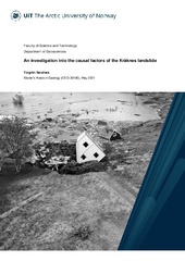
An investigation into the causal factors of the Kråknes landslide
(Mastergradsoppgave; Master thesis, 2021-05-15)On the 3rd of June 2020, a landslide measuring 600 meters long and 160 meters wide initiated along the shoreline at Kråknes, in Alta municipality in Troms and Finnmark County. The landslide was comprised of a series of smaller slides, which destroyed eight houses and a caravan in the process. Fortunately, no human lives were lost in the event. Due to the widespread presence of sensitive clays along ... -
Isstrømdynamikk og havbunnsgeomorfologi fra deglasiasjonen av det sørvestlige Barentshav, basert på 3D-, 2D-seismisk og batymetrisk data
(Master thesis; Mastergradsoppgave, 2013-08-15)Batymetridata og 2D og 3D seismisk data og er brukt for å kartlegge formelementer i det sørvestlige Barentshavet. Megaskala glasiale lineasjoner (MSGL) kartlagt i de glasiale trauene indikerer tidligere isstrømaktivitet i Bjørnøyrenna og Djuprenna. Dynamiske endringer i strømningsretning er påvist fra MSGL med ulike orienteringer som kutter hverandre. Ut fra kartlagte MSGL er 10 strømningssett laget. ...