English
 norsk
norskBlar i tittel Mastergradsoppgaver i geologi
Viser treff 191-210 av 274
-
The regional Cretaceous development of the southeastern part of the Norwegian Barents Sea- from seismic interpretation
(Master thesis; Mastergradsoppgave, 2018-05-15)This study sheds new light on the regional Cretaceous development of the southeastern part of the Norwegian Barents Sea. The study area is in the former disputed area between Norway and Russia, which after the agreement on the new borders in 2010 was opened to petroleum activity in 2013. Consequently, the southeastern Barents Sea is still a frontier area with less scientific knowledge, compared to ... -
Regional structural analysis of rock slope failure types, mechanisms and controlling bedrock structures in Kåfjorden, Troms
(Master thesis; Mastergradsoppgave, 2018-05-15)Unstable areas producing rock slope failures come with large consequences. The understanding of why and where they might occur is necessary to mitigate damage and prevent casualties. A total of 133 unstable rock slopes have been detected in Troms, Northern Norway, evidencing that a great focus on these geohazards is important. This study has focused on seven unstable rock slopes in Kåfjorden, Troms, ... -
The regional upper Paleozoic development of the SE part of the Norwegian Barents Sea - from seismic interpretation
(Master thesis; Mastergradsoppgave, 2018-05-15)This thesis focuses on the Barents Sea South East (BSSE), and the overall goal has been to investigate the regional upper Paleozoic development in the SE part of the Barents Sea. After more than four decades of negotiation between Norway and Russia, a delineation agreement came in effect in 2011. Today, the area known as BSSE is opened up for petroleum operations. As part of the opening of the BSSE, ... -
Rekonstruksjon av paleomiljø i Kongsfjordrenna, vest for Svalbard, de siste ~11 800 år, basert på bentiske foraminiferer og sedimentologiske undersøkelser
(Master thesis; Mastergradsoppgave, 2007-11-15)Sedimentkjerne NP05-11-21GC fra Kongsfjordrenna vest for Spitsbergen er analysert for å kartlegge utviklingen av paleomiljø de siste ~11 800 år. Analysene er basert på undersøkelser av bentiske foraminiferer og sedimentologiske egenskaper. Kjernen er 5,15 meter lang og 104 prøver er analysert med hensyn på fauna, droppstein og kornfordeling. Sedimentenes fysiske egenskaper er målt ved hjelp av en ... -
Relationship between fluid leakage and faulting along the western and northern margin of the Hammerfest Basin
(Master thesis; Mastergradsoppgave, 2014-05-15)Abstract This thesis focuses on establishing a causal relationship between potential fluid sources, fluid migration pathways, shallow gas accumulations and potential gas hydrates in the western part of the Hammerfest Basin, SW Barents Sea. Two 3D seismic surveys (LN0901 and ST8320R00) were used to map fluid flow, stratigraphy, structure, fluid flow and other fluid-related features along the western ... -
Relationship between glacial erosion and fluid flow inferred from 3D seismic data : SW Barents Sea
(Master thesis; Mastergradsoppgave, 2012-06-05)This Master thesis investigates the relationship between glacial erosion, glaciotectonically displaced sediment blocks and indications of fluid flow and shallow gas accumulations in buried glacial sediments of the south-western Barents Sea margin. The thesis is based on two three-dimensional (3D) seismic datasets, NH98003 and EL0001, the two-dimensional (2D) seismic survey NH9702 and exploration ... -
The relationship between shallow anomalies and gas-flaring on the flank of the Nordkapp Basin in the SE Barents Sea
(Master thesis; Mastergradsoppgave, 2020-05-18)This study investigates the north-east-subbasin of the Nordkapp Basin in the Barents Sea. Main focus has been on mapping shallow seismic anomalies from 3D data, their potential association with faulting and sub-surface structures, and further to compare the occurrence of seismic anomalies to possible gas-flares above the seabed from water column data. The stratigraphic intervals from Triassic to ... -
Relationships between metamorphism and deformation in the Nordmannvik nappe, south of Lyngseidet: a focus on high grade relics
(Master thesis; Mastergradsoppgave, 2013-05-13)The Nordmannvik nappe (Lyngen fjord, northern Norway) is a high grade tectonic unit dominated by mylonitic garnet-kyanite-mica gneisses, with additional calc-sillicates, mafics and high grade relics. The unit was principaly deformed during the Scandian event of the Caledonian orogeny, reaching at least an upper amphibolite facies. A metamorphic peak, set at a minimum of 750°C / 0.9 GPa, has been ... -
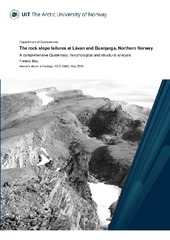
The rock slope failures at Låvan and Dusnjarga, Northern Norway. A comprehensive Quaternary, morphological and structural analysis
(Master thesis; Mastergradsoppgave, 2020-05-15)Rock avalanches and subsequent displacement waves represented the deadliest natural disaster in Norway in the past century. The two deep-seated and unstable slopes Dusnjarga and Låvan in Troms county (Norway) are clearly defined by morphological deformation features. Due to the steep fjord setting, a potential catastrophic rock avalanche could pose a severe threat to people and infrastructure along ... -
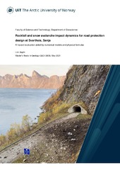
Rockfall and snow avalanche impact dynamics for road protection design at Svarthola, Senja. A hazard evaluation aided by numerical models and physical formulas
(Master thesis; Mastergradsoppgave, 2021-05-14)Rockfalls and snow avalanches are a major natural hazard and common phenomenon in mountainous areas in Norway, endangering people and infrastructure. Svarthola, on Fv 862, Senja, is a 100 m long unprotected stretch of road that experiences a high frequency of mass movements. The road is situated at a tunnel portal, between a 100 m high cliff and the fjord. As such, it is the only short access route ... -
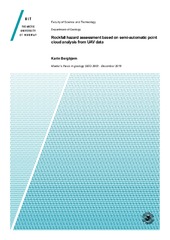
Rockfall hazard assessment based on semi-automatic point cloud analysis from UAV data
(Master thesis; Mastergradsoppgave, 2018-12-29)Slettind in Flaktstad municipality, Lofoten in Nordland, has numerous rockfalls throughout the year. Rockfalls hit Fv 805 on a weekly basis, and it is estimated the most dangerous road in Nordland county. A rock avalanche hit the road winter 2017 closing it for 2 weeks, and isolating the small village Myrland. Statens Vegvesen consider to build a tunnel to protect the road but the failure mechanisms ... -
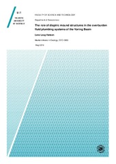
The role of diapiric mound structures in the overburden fluid plumbing systems of the Vøring Basin
(Master thesis; Mastergradsoppgave, 2018-05-15)The overall aim of this thesis is to better understand the development and emplacement of diapiric mound features in the Vema Dome area, located in the Vøring basin on the mid-Norwegian continental margin. Two 3D seismic surveys, ST9603R99 and BPN9601, were interpreted in this study, in order to investigate the diapiric mounds and their relationship with an underlying fluid plumbing system including ... -
The Roles of Light Absorbing Particles in the Norwegian Arctic Snow
(Mastergradsoppgave; Master thesis, 2023-05-08)Light absorbing particles (LAPs) such as black carbon (BC) and dust can reduce snow albedo and have a positive radiative forcing. Previous studies investigating LAP in snow in Tromsø focused on black carbon (BC) also called elemental carbon because it has human sources, but dust should also be considered because, while largely from natural sources, it is present in higher concentrations. To quantify ... -
Salt movements in three provinces in the southwestern Barents Sea: development, timing, and implications of regional structural differences
(Master thesis; Mastergradsoppgave, 2019-05-15)This study has investigated salt movements in the Nordkapp Basin, on the Loppa High (Svalis Dome) and on the Bjarmeland Platform (Samson- and Norvarg domes). The aim is to discuss how differences in salt growth potentially relates to the structural evolution of - and differences between - these three provinces. Evaluation of seismic 2D- and 3D data together with well correlation, allowed a regional ... -
Sammenhengen mellom landskap og tektonikk på Moskenesøya og Flakstadøya, Lofoten.
(Master thesis; Mastergradsoppgave, 2008-12-04)Lofoten utgjør en opphevet horst i forhold til omkringliggende bassenger og består hovedsakelig av prekambrisk grunnfjell. Tidligere modeller viser at landområdene og sokkelområdene utenfor Lofoten ser ut til å ha hatt en lik ekstensjonshistorie med flere faser av forkastningsbevegelser, innsynkning og oppheving gjennom mesozoikum og kenozoikum. Steile strukturer i berggrunnen danner svakhetssoner ... -
Sand waves and sediment transport on the SW Barents sea continental slope
(Master thesis; Mastergradsoppgave, 2012-11-15)I study a sand-wave field in ~600 meters water depth on the continental slope offshore Northern Norway. Using multibeam bathymetry data from 2008 and 2011 and P-Cable high-resolution 3D seismic data from 2011, I characterize the field. Sand waves reach up to 6.6 m in height and have wavelengths as large as 140 m. They are mostly asymmetric in shape with the steepest side dipping to the northwest, ... -
Sedimentary environment and seismic anomalies of the upper Brygge and Kai formations on the northern part of the Mid-Norwegian Continental Shelf
(Master thesis; Mastergradsoppgave, 2017-05-15)The sedimentary environment and seismic anomalies of the upper Brygge and Kai formations on the northern part of the Mid-Norwegian Continental Shelf is analysed from 3D seismic data and the exploration well 6604/2-1. This was done in order to give a better understanding of the paleo-climatic development in the period before the establishment of the large-scale ice sheets of the Northern Hemisphere, ... -
Sedimentary processes and depositional environment of the distal part of the Bear Island Trough Mouth Fan, SW Barents Sea reconstructed from a giant piston core
(Master thesis; Mastergradsoppgave, 2016-05-15)Multi-proxy analyses of the giant piston core MD992301 (including lithostratigraphy, physical properties and XRF-scanning) and analyses of swath bathymetry data was integrated in order to reconstruct the glacial history and paleoenvironment of the distal parts of the INBIS channel, located between the distal Bear Island Trough Mouth Fan and Storfjorden Trough Mouth Fan. Based on the swath bathymetry ... -
Sedimentary processes and palaeoenvironment in Van Keulenfjorden, Spitsbergen
(Master thesis; Mastergradsoppgave, 2011-05)Swath bathymetry, high resolution seismic and core data are analysed to describe the Late Weichselian and Holocene sedimentary processes and palaeoenvironment in Van Keulenfjorden, Spitsbergen. Bottom currents, the bathymetry of the fjord and the distance from sediment sources are the controlling factors for the sediment distribution as indicated by isopach maps. Sandur deltas at the mouth of ... -
Sedimentary processes and paleoenvironment reconstructions in fjords comprising the Bergsfjord peninsula, Northern Norway
(Master thesis; Mastergradsoppgave, 2018-05-16)Low-resolution bathymetry, high-resolution seismic data (chirp) and multi-proxy analyses of three sediment gravity cores were integrated to study sedimentary processes with the purpose of reconstructing paleoenvironments in the three north Norwegian fjords Øksfjorden, Bergsfjorden and Jøkelfjorden since the last glacial. These three fjords are located on the Bergsfjorden peninsula and surround the ...