English
 norsk
norskBlar i tittel Mastergradsoppgaver i geologi
Viser treff 103-122 av 271
-
Ice sheet dynamics in the Brunt Basin, Weddell Sea, Antarctica, since the last glacial period
(Master thesis; Mastergradsoppgave, 2016-11-15)High-resolution swath bathymetry, TOPAS sub-bottom profiles and four gravity cores from the Brunt Basin, southeastern Weddell Sea in Antarctica, were analysed with the purpose of reconstructing the ice sheet dynamics since the last glacial. Data collection was carried out by the British Antarctic Survey (BAS) and data analyses were carried out in a collaboration between the Department of Geosciences ... -
Ice stream dynamics inferred from seismic geomorphology from the Bjørnøyrenna and Nordkappbanken area, SW Barents Sea
(Master thesis; Mastergradsoppgave, 2013-05-15)The aim of this master thesis is to investigate ice streams dynamics in Bjørnøyrenna and Nordkappbanken areas in south-west Barents Sea shelf Ice streams are responsible for the drainage of majority of ice from ice sheet and play a key role in the dynamic nature and stability of ice sheets, based mainly on six 3D seismic data sets,. Regional 2D lines are also used to establish the regional stratigraphy ... -
Ice-sheet Dynamics and Postglacial Sedimentary Processes of Coastal Søre Sunnmøre, Southwest Norway
(Master thesis; Mastergradsoppgave, 2020-05-15)Submarine glacial landforms have been identified and mapped in order to reconstruct ice sheet dynamics and to describe postglacial sedimentary processes of coastal Søre Sunnmøre in southwestern Norway which lies between 62 and 62.5⁰N. Landform identification has been accomplished through analysis of high-resolution multibeam echosounder (MBES) bathymetric data, backscatter data, LiDAR data, video ... -
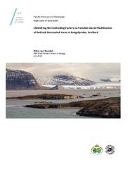
Identifying the Controlling Factors on Variable Glacial Modification of Bedrock Dominated Areas in Kongsfjorden, Svalbard
(Master thesis; Mastergradsoppgave, 2018-07-05)This thesis aims to better understand the variability of glacial erosion along glacial troughs located in high latitude settings, through a case study of Kongsfjorden, Svalbard. The research question of this thesis is to identify the controlling factors on variable glacial modification of the bedrock dominated areas in Kongsfjorden. Fieldwork was conducted to analyze bedrock structures and ... -
Integrated characterization of igneous intrusions in Central Spitsbergen
(Master thesis; Mastergradsoppgave, 2017-05-15)Igneous intrusions have a strong influence on petroleum systems, groundwater aquifers, and CO2 storage reservoirs, particularly because they can act as either barriers to, or carriers for fluid flow. This depends on several syn- and post emplacement processes, including fracture development in the intrusion and the host rocks, contact metamorphism of the host rocks, and hydrothermal activity. ... -
Integrated characterization of the Upper Permian Kapp Starostin Formation in central Spitsbergen, Svalbard. From outcrop to geomodel.
(Master thesis; Mastergradsoppgave, 2018-05-14)Natural fractures significantly contribute to improved reservoir quality and recovery factor, especially in carbonate reservoirs. It is important to characterize the matrix and fracture properties, as well as their interaction, in order to describe the natural fracture system and improve the understanding of its effects on a reservoir. This study integrates multi-scale outcrop data from central ... -
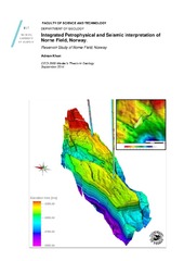
Integrated Petrophysical and Seismic interpretation of Norne Field, Norway.
(Master thesis; Mastergradsoppgave, 2014-09-16)The aim of this thesis is to evaluate petrophysical properties and seismic interpretation of main reservoirs of Norne field in Mid Norwegian sea. Petrophysical evaluation helps in getting familiar with reservoir characterization using wireline logs data. The main concentration has been given to evaluate different reservoir properties i.e. porosity, shale volume, water saturation, hydrocarbon saturation, ... -
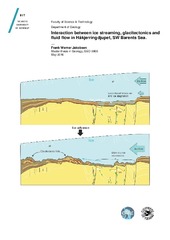
Interaction between ice streaming, glacitectonics and fluid flow in Håkjerringdjupet, SW Barents Sea
(Master thesis; Mastergradsoppgave, 2016-05-13)By using high resolution multibeam swath batymetry and 2- and 3D seismic data this thesis investigate the interactions between ice streaming, glacitectonics and fluid flow in Håkjerringdjupet. The source area for a glacitectonic hill-hole pair is located directly above spatial fluid accumulations assosiated to a fault complex. Glacitectonic deposits are found directly downstream from this area. We ... -
Interaction of submarine tailings with natural sediments in three northern Norwegian coastal areas. Sedimentological, mineralogical and geochemical constraints
(Master thesis; Mastergradsoppgave, 2018-05-15)Submarine tailings placements (STPs) is an alternative practice of handling mine waste, which involves deposition of tailings into submarine environments. However, the environmental impacts of STPs remain poorly understood. This thesis is a contribution to improve the understanding of how submarine tailings placements interact with natural sediments. It is based on multi-proxy analyses of 10 sediment ... -
Investigating the variability of Atlantic water inflow to the southwestern Barents Sea through Bjørnøyrenna during the Late Glacial and Holocene based on benthic foraminifera and sediment properties.
(Master thesis; Mastergradsoppgave, 2017-05-15)This study is a part of the Barents Sea drill cuttings research initiative (BARCUT), investigating the inflow of Atlantic water to the southwestern Barents Sea during the Late Glacial and Holocene as well as providing data for future references. -
An investigation into the causal factors of the Kråknes landslide
(Mastergradsoppgave; Master thesis, 2021-05-15)On the 3rd of June 2020, a landslide measuring 600 meters long and 160 meters wide initiated along the shoreline at Kråknes, in Alta municipality in Troms and Finnmark County. The landslide was comprised of a series of smaller slides, which destroyed eight houses and a caravan in the process. Fortunately, no human lives were lost in the event. Due to the widespread presence of sensitive clays along ... -
Isstrømdynamikk og havbunnsgeomorfologi fra deglasiasjonen av det sørvestlige Barentshav, basert på 3D-, 2D-seismisk og batymetrisk data
(Master thesis; Mastergradsoppgave, 2013-08-15)Batymetridata og 2D og 3D seismisk data og er brukt for å kartlegge formelementer i det sørvestlige Barentshavet. Megaskala glasiale lineasjoner (MSGL) kartlagt i de glasiale trauene indikerer tidligere isstrømaktivitet i Bjørnøyrenna og Djuprenna. Dynamiske endringer i strømningsretning er påvist fra MSGL med ulike orienteringer som kutter hverandre. Ut fra kartlagte MSGL er 10 strømningssett laget. ... -
Jettan, Nordnesfjellet, Kåfjord, Troms – indre geometri og struktur, kinematikk og styrande faktorar av eit ustabilt fjellparti, basert på strukturellanalyse, geomorfologi og overvakingsdata
(Master thesis; Mastergradsoppgave, 2013-11-21)Det ustabile fjellpartiet, Jettan, har blitt studert med ei multidisiplinær tilnærming. Dette inkluderer strukturelle og geomorfologiske analyser i felt, studiar av sann-tid og periodisk overvaking og bruk av kart og digitale elevasjonsmodellar. Formålet har vore å avdekke indre struktur og geometri, kinematikken og kontrollerande faktorar for dei ustabile massane. Det ustabile fjellpartiet er ... -
Kontakten mellom Tromsødekket og Skattøra migmatitt kompleks (Nakkedalsdekket) NØ for Tromsdalstinden : kinematiske indikatorer og metamorfose
(Master thesis; Mastergradsoppgave, 2011-05)Kartlegging av kontakten mellom Tromsødekket og SMC (Nakkedalsdekket) i felt og mikroskopstudiet av tynnslip fra feltområdet, viser en to episoder (DT1 og D2) med deformasjon i Tromsødekket og tre episoder (DS1, DS2 og D2) i SMC. SMC og Tromsødekket viser forskjellig metamorfose før enhetene kom i kontakt i en sen fase av D2 episoden. I Tromsødekket er det observert en tidlig NØ-SV forkortning tolket ... -
Kortejärvi Veiki moraine plateau - a key to the glacial history of northern Sweden
(Master thesis; Mastergradsoppgave, 2020-03-30)In many parts of Scandinavia, the glacial history is more well established than in northern Sweden. The Veiki moraines in northeastern Sweden presumably store information about the Weichselian glaciations. The moraines were formed when stagnant ice was slowly melting under a thick debris cover, forming water filled sinkholes, that were left as elevated ice-walled lake plains when the ice finally ... -
Land sokkel korrelasjon av sprø mesozoiske og paleozoiske forkastninger i et profil over Vestfjordbassenget, Vestvågøya og Ribbebassenget.
(Master thesis; Mastergradsoppgave, 2015-08-19)Denne studien har studert geomorfologi og sprø forkastninger i et profil som strekker seg fra Vestfjordbassenget, over Vestvågøya/Lofotryggen og Ribbebassenget. Det flate slettelandskapet sentralt på Vestvågøya skiller seg ut fra landskapet ellers i Lofoten, som stor sett består av alpint fjellandskap. Slettelandskapet er omgitt av alpine asymmetriske fjell langs kysten i NØ og NV. Fjellenes brattside ... -
Land-sokkel korrelasjon av tektoniske elementer i ytre del av Senja og Kvaløya i Troms
(Master thesis; Mastergradsoppgave, 2011-05)Feltarbeid og analyser av batymetriske-, seismiske- og gravimetriske data er sammenstilt for å korrelere tektoniske elementer i ytre del av Senja og Kvaløya i Troms. Berggrunnen i kystområdene på nordøstlige Senja og Kvaløya i Troms tilhører Vest-Troms gneis region og består av neoarkeiske og paleoproterozoiske tonalittisk gneis og mafiske intrusiver (Kattfjordkomplekset), samt metasuprakrustale ... -
Landform assemblages in inner Kongsfjorden, Svalbard: evidence of recent glacial (surge) activity
(Master thesis; Mastergradsoppgave, 2013-05-15)Swath bathymetry and chirp data have been used to investigate the submarine landform assemblages in inner Kongsfjorden, Svalbard, to reconstruct glacial dynamics during the Late Holocene. Multiple sets of landforms include two types of glacial lineations (groove-ridge features and small, drumlinoid ridges), terminal moraines and associated debris lobes, as well as small push moraines, and indicate ... -
Landskap og prosesser på Vesterålsbanken
(Master thesis; Mastergradsoppgave, 2009-06-12)Oppgaven beskriver og tolker storskalalandskap og geomorfologiske formelementer og prosesser på Vesterålsbanken, som er en del av norsk kontinentalsokkel mellom 68 og 70°N. Svært detaljerte batymetri- og backscatterdata (dybde og akustisk reflektans) er behandlet i GIS (geografiske informasjonssystemer), og resultatene blir presentert i form av kart. Vesterålsbanken er et område som er preget ... -
Last Glacial Maximum – Holocene palaeoenvironment in Bessel Fjord and southwestern Dove Bugt, Northeast Greenland
(Master thesis; Mastergradsoppgave, 2020-05-14)Marine studies reconstructing ice sheet conditions on the Northeast Greenland shelf and adjacent fjords since the Last Glacial Maximum (LGM) are sparse. As a result, the timing and origin of the deglaciation of the ice sheet over marine areas is not well constrained. This thesis aims to improve our understanding of the LGM, deglaciation, and Holocene ice dynamics of the Greenland Ice Sheet (GrIS) ...